Help protect Nidderdale’s rivers and becks by recording invasive species
People across Nidderdale are being asked to help protect rivers, becks, paths, field edges and woodlands by recording sightings of invasive non-native species.
As part of Invasive Species Week, which runs from 22 to 28 June, Nidderdale National Landscape is encouraging farmers, landowners, anglers, walkers and local communities to use INNS Mapper – a free app and website – to log sightings.
The records will help build a clearer picture of where invasive species are already established, where they may be spreading and where practical control work could be needed in future.
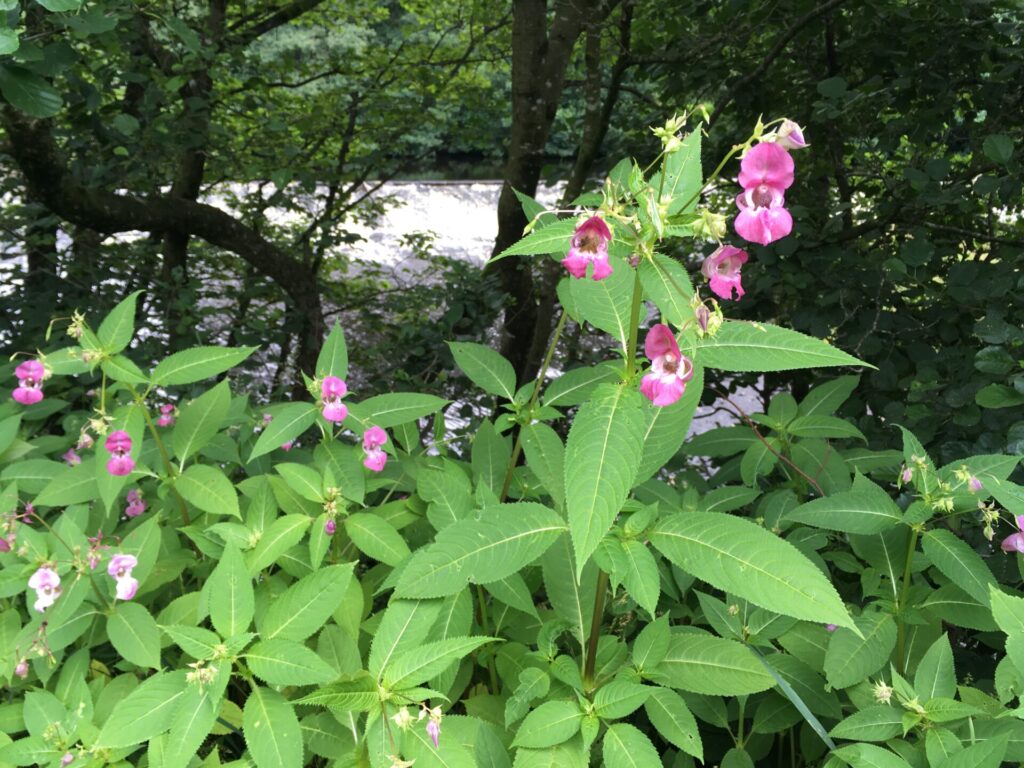
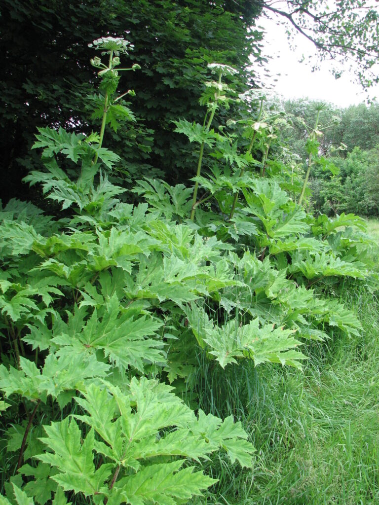
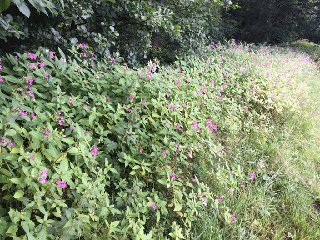
Species that can be recorded include Himalayan balsam, Japanese knotweed, Himalayan knotweed, giant hogweed and signal crayfish.
Himalayan balsam is already widespread along many watercourses. It can crowd out native plants and, when it dies back in winter, leave riverbanks exposed to erosion.
Japanese knotweed and Himalayan knotweed have also been confirmed in the landscape, while giant hogweed is present but not yet widespread, making early reporting especially important.
People should not touch giant hogweed. Its sap can cause serious burns and damage eyesight. Anyone who sees it should record the location safely through INNS Mapper and seek advice before taking any action.
Signal crayfish have also been confirmed in Nidderdale watercourses. They can carry crayfish plague, which has had a serious impact on native white-clawed crayfish populations across Yorkshire.
The call-out comes as the National Landscape team says Farming in Protected Landscapes funding may be available to support eligible farmers, landowners and land managers with practical Himalayan balsam control projects, including hand-pulling.
Matt Trevelyan, Farming in Protected Landscapes officer for Nidderdale National Landscape, said: “Good records are one of the most useful tools we have when it comes to understanding invasive species.
“People who live, work or spend time in the landscape are often the first to notice when something appears in a new place or starts spreading along a riverbank, path, field edge or woodland.
“By taking a few minutes to record a sighting through INNS Mapper, people can help build a much clearer picture of what is happening across Nidderdale. That information can then support future conversations with farmers, landowners, community groups and partner organisations about where action may be needed.”
Farmers, landowners and land managers dealing with Himalayan balsam, or wanting to understand what support may be available, can contact Matt Trevelyan by emailing [email protected] or calling 07745 544 872.
INNS Mapper is free to download from any app store or can be used online at www.innsmapper.org.
Anyone recording a sighting should only do so where it is safe and should avoid touching or disturbing any plant or animal they are unsure about.
Gallery