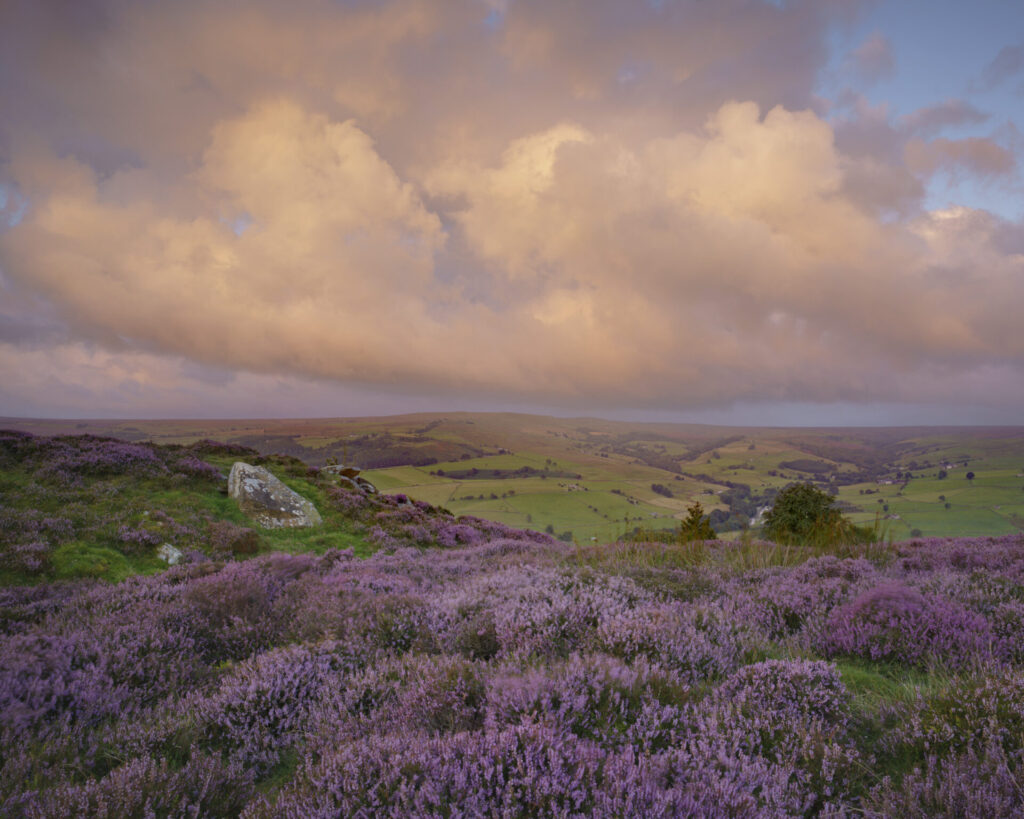
You can walk freely on mapped areas of open access without having to stay on paths.
This includes mountain, moor, heath, downland and registered common land, known as access land.
You can walk, ramble, run, climb and watch wildlife but you cannot cycle, horse ride, drive a vehicle or camp. Access land is marked in pale yellow on Ordnance Survey Explorer maps or is shown on the Natural England website.
For your safety, always carry an orange Ordnance Survey ‘Explorer’ map. Walking on open access land can be challenging, as you will often be a long way from recognised paths. Stiles and gates may be sparse. Make sure you have good navigation skills and suitable clothing.
Before setting out for a walk in an open access area, check that it is open, either on the Natural England website, by phoning 0845 100 3298 or at one of our access information points. These can be found on areas of moorland across the National Landscape and contain local information on where access land is and will display closure notices for that area. They are found at Askwith Moor, Blubberhouses, Greenhow, Harper Hill, Middlesmoor, Nought Moor, Scar House and Tom Corner.
Closures and restrictions
The list below shows areas where right of access is not available at any time, even if it appears on maps of access land.
- Buildings and the land attached to them (for example courtyards)
- Land within 20 metres of a house, or a building containing livestock
- Parks and gardens
- Land under structures such as electricity substations, wind turbines or telephone masts (though this does not prevent use of access land around them)
- Quarries and other active mineral workings
- Railways and tramways
- Golf courses and race courses
- Aerodromes
- Land being developed in one of the ways above
- Arable land ploughed for the growing of crops within the past year
- Temporary livestock pens
- Racehorse training gallops (eg. Ministry of Defence training areas)
Landowners can close their moor for 28 days a year, usually for public safety reasons while carrying out management tasks. Natural England holds up-to-date closure information on its website. Key dates to note are:
- Ground nesting bird season – March to July
- Grouse shooting season – 12 August to 10 December
- Pheasant shooting season – 1 October to 1 February
- Heather Burning Season – 1 October to 15 April
- Lambing – March to end of May (uplands)
The Countryside Code, launched in July 2004, urges people to:
- Be safe, plan ahead and follow any signs
- Leave gates and property as you find them
- Protect plants and animals and take your litter home
- Keep dogs under control
- Consider other people
Dogs
Most of the access land in Nidderdale National Landscape is managed for grouse shooting and owners can exclude dogs at all times.
Check before you head out by looking at the open access pages of the Natural England website and keep an eye out for signs when out on the moors.
Even if dogs are allowed, they must be kept on short leads of no more than two metres between 1 March and 31 July to protect ground nesting disturbance or at any time of year when near livestock.
Fire
Access land is sometimes closed due to the risk of uncontrolled fires. Large areas of moorland in the National Landscape have been lost to wildfires in the past and the risk increases as the summer unfolds.
It is all too easy for uncontrolled fires on the moors to start. A dropped match, smouldering cigarette ends or even a carelessly discarded bottle can set the dry heather and the peat underneath, ablaze. The open and often windy conditions of moorland mean that fires can easily burn out of control and can go unnoticed for miles causing vast devastation.
In order to avoid this devastation there are a few simple rules that should be followed:
- Never light a fire on moorland – that includes gas stoves and barbecues too
- Never stub cigarettes out on moorland or throw smoking materials out of a car window when driving through moorland – always take cigarette ends and spent matches home
- Never leave broken glass or discarded bottles behind on moorland
- Respect all warning signs. If you see a moorland fire at any time outside of the heather burning season call 999 and alert the fire brigade. If possible also report the fire at the nearest house but do not attempt to fight the fire without assistance
Fire Severity Index
The CRoW Act gives relevant authorities the right to restrict public access where they are satisfied that, “by reason of exceptional conditions of weather or any exceptional change in the condition of the land, the exclusion or restriction is necessary for the purposes of fire prevention”. Relevant authorities are those that manage open access rights in England, and include Natural England and the Forestry Commission. The Fire Severity Index (FSI) was developed to give an objective methodology to determine when exceptional conditions occur to justify the closure of open-access land.
The FSI assesses the risk of fire in any particular area, as determined by a combination of ground and weather conditions. It was developed by the Met Office and provides an assessment (for the current day and a 5-day forecast) based on wind speed, temperature, time of year and rainfall.
The FSI is a 5-tiered scale, which rates the severity of the fire risk as follows:
1. Very low severity
2. Low fire severity
3. Moderate fire severity
4. High fire severity
5. Exceptional fire severity
The information is updated daily and displayed on 10km x 10km map squares covering the whole of England and Wales. It is used operationally to inform decision-making and fire management on access land.
Fire prevention restrictions are applied during exceptional conditions, as determined by a FSI level 5. Once this level has been reached, access land covered by CRoW will be ‘closed’. However any access restrictions do not apply to Public Rights of Way.
How the relevant authorities choose to use this information with respect to limiting access varies. Members of the public are advised to look out for posted signage relating to fire risk, and to follow all instructions.
** Please note that the tourism information on this website is designed to provide an overview of opportunities in the area. The Nidderdale National Landscape team do not have the facilities or resources to deal with individual tourism enquiries and these should be directed to the tourist information office at Nidderdale Plus or one of the other local Tourist Information Centres.