History and Heritage
Dry Stone Walls and Field Barns
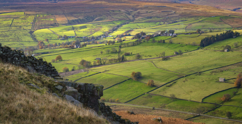
The Nidderdale landscape you see today is a patchwork of fields neatly divided up by dry stone walls and dotted with traditional field barns.
Miles of linear dry stone walls were built in Nidderdale during the eighteenth and early nineteenth centuries as part of a large-scale enclosure of common land taking place across Britain. Some field walls are amongst the oldest manmade features of the Dales but most of those still in use were built during the last 500 years.
As well as dry stone walls, traditional field barns are one of Nidderdale’s most characteristic features. Originally constructed to shelter cattle during the winter and store hay, these barns allowed farmers to dry and store grass close to where it was cut, reducing the need to transport hay back to the main farmstead.
Changes in modern agricultural practices mean that many of these field barns are no longer practical for today’s farmers. As a result, there is little incentive to maintain them. Some barns have been left to deteriorate whilst others have found new life as converted homes.
Explore it for yourself …
The shape of the landscape and its structures reveal many more clues that can give us an insight into how people have used it throughout history.
As part of the Upper Nidderdale Landscape Partnership, we produced this helpful guide to Upper Nidderdale’s key features – Reading the Upper Nidderdale Landscape.
Keep your eyes peeled as you explore the area to uncover traces of how people have lived on and worked the land over last 3000 years.